Waipoua River flood management preferred option for Masterton
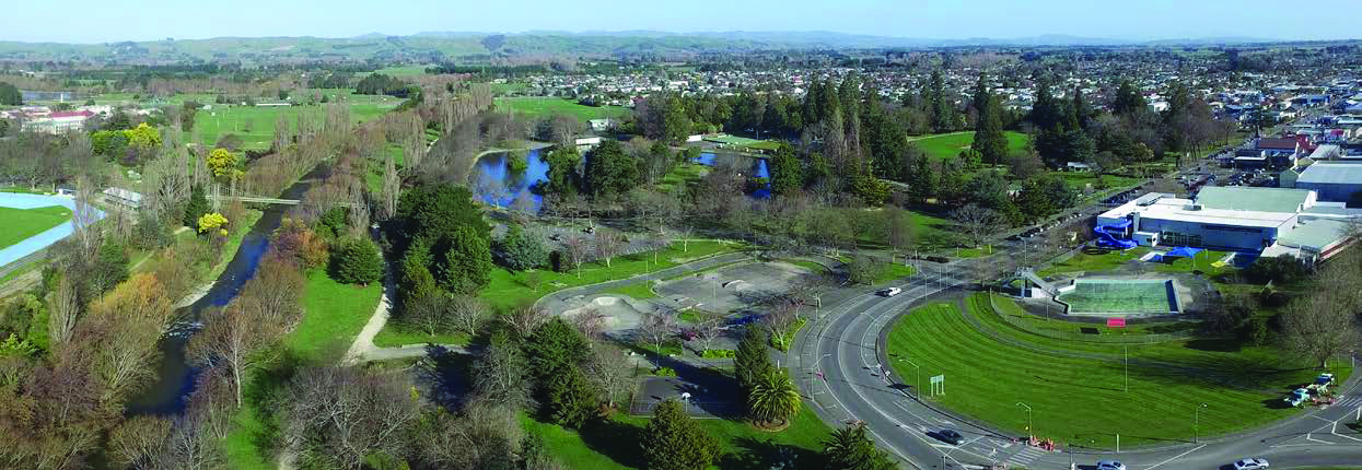
Flooding impacts more people, more often than any other natural hazard in the Greater Wellington Region. We’re looking at the possible impacts of flooding from the Waipoua River to Masterton’s township and industrial areas.
Background
A key role of local authorities is to work with communities to protect them from the effects of hazards, including flooding.
Masterton is at risk of flooding from the Waipoua River with a 1% annual exceedance probability (AEP) flood (a flood that has a 1% chance of happening in any given year). This flooding is worse when considering the predicted effects of climate change.
The Te Kāuru Upper Ruamāhanga Floodplain Management Plan (PDF 26 MB) outlines a programme of work for how Greater Wellington plans to manage flood and erosion risks within the Upper Ruamāhanga catchment.
This plan identified that further work was needed to understand the risk to Masterton and proposed responses to manage this risk through the urban area.
Following a community meeting in 2019, Greater Wellington began working alongside community members and mana whenua to explore ways to best manage the current and future flood risk to Masterton. The team worked with experts and collected as much data as possible to propose four concepts to improve protection for the community from the impacts of flooding.
The four concepts were:
- Improve and extend existing stopbanks
- Undertake extensive work in the river channel
- Retreat some stopbanks
- Implement nature-based solutions in the upper catchment
Public feedback on these concepts was open from 17 February to 16 March 2025. Thank you to everyone who made a submission. Your feedback, alongside other considerations such as environmental and economic, and Te Mana o Te Wai, have helped to determine a preferred option to manage flood risk along the urban reach of the Waipoua River.
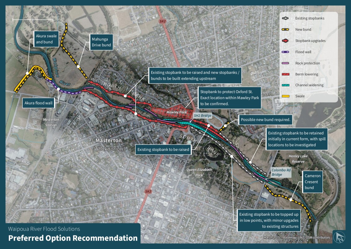
The preferred option
The preferred option to manage the flood risk through Masterton is a combination of each of the four proposed concepts and can be summarised as follows:
- Upgrading and extending most of the existing stopbanks in the urban reach.
- There are two areas where the height and alignment of the stopbank has not been confirmed and could possibly be retreated further from the river. These areas are on the true left/northern bank, alongside Mawley Park and between the Waipoua River swing bridge and the Colombo Road bridge. The final location of these stopbanks will be determined by Masterton District Council and Greater Wellington.
- Some mechanical works are also proposed within the river channel to improve the capacity of the river, especially around the bridges.
- It is envisioned that nature-based solutions will play a role in longer-term management of flood risk. Any implementation of nature-based solutions will provide additional resilience long-term as well as wider benefits.
- Planning controls, emergency management planning and flood warning will add additional resilience, benefits to people outside the defended area and help manage flood risk increasing over time through inappropriate development
The preferred option design is currently conceptual only and further investigation and refinement is proposed in future stages of the work.
A detailed report describing the preferred option is provided here:


How much will this cost?
Based on our current knowledge, high level estimates suggest that the cost to implement the preferred option is of the order of $30 million. Based on the current rating classification, this equates to an average total rate increase of $10 per $100,000 CV for local Masterton rate payers. For a property with a value of $540,000, this would be an additional $54 per year.
For regional rate payers outside of the Masterton area (for example, Waikanae), the rates increase would be less than $0.50 per $100,000 CV. These costs could be less if funding from central government is available.
Waipoua Project Team
- Andrew Stewart (facilitator)
- Andrew Donald
- Gary Foster
- Ian Gunn
- Michael Hewison
- Ra Smith
- Members of Greater Wellington
- Members of Masterton District Council
We also wish to acknowledge the participation and inputs from other community members to the project team.
Get in touch
- Phone:
- 0800 496 734
- Email:
- info@gw.govt.nz